Improving Satellite Digital Elevation Models (DEM) using AI
Project Reference :
AISG-100E-2019-045
Institution :
National University of Singapore (NUS)
Principal Investigator :
Professor Philip Liu Li-Fan
Technology Readiness :
6 (Technology demonstrated in relevant environment)
Technology Categories :
AI - Deep Learning
Background/Problem Statement
The digital elevation model market accounted for almost 10% market share of GIS market globally and is projected to register a 16.9% CAGR to reach $4.7 billion by 2029. The growth in the DEM market attributes to the rising adoption of DEM software across various applications.
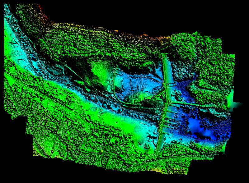
Acquiring a high resolution and high accuracy Digital Elevation Model (DEM) is very challenging as it is very time-consuming and costly. The cost of acquiring high-resolution commercial satellite data is substantial. Publicly accessible satellite DEM data are not of high accuracy or resolution.
Solution
A robust DEM improvement scheme using an artificial neural network (ANN) that was trained with a high spatial resolution surveyed DEM and applied to faraway sites, one with an equally high-resolution DEM and another with no surveyed DEM. The scheme used multispectral imagery and an ANN to reduce the error of the original high-resolution satellite DEM. The degree of improvement, ranging from 21% to 65%, is different based on land covers. The improved DEM showed much clearer land shapes, particularly roads and buildings than the original DEM.
- Satellite DEM Improvement Using Multispectral Imagery and an Artificial Neural Network
- Application of Multi-Channel Convolutional Neural Network to Improve DEM Data in Urban Cities
Benefits
A well-trained ANN, with a rich variety of patterns, can be very useful for developing countries where a DEM is not available, is confidential, or of low quality. In addition, the trained ANN can be used to produce high-accuracy DEMs elsewhere, quickly and at a relatively low cost.
Potential Application(s)
The digital elevation model (DEM) is crucial for various applications, such as land management and flood planning ( including flash flood management), hydrological modeling and bathymetric analysis, disaster prevention, infrastructure, agriculture, 3D visualization, 3D mapping, gravity measurements, and terrain correction, as it reflects the actual topographic characteristic on the earth’s surface.
We welcome interest from the industry for collaboration/ co-development / customisation of the technology into a new product or service. If you have any enquiries or are keen to collaborate, please contact us.